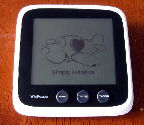
It’s a small achievement, but I got my first application running on the Openmoko WikiReader. It’s a hacked version of their application that only displays a image and single line of text but, still, it’s a start:
I can think of a range of uses for the device so far:
- A scrollable map with details on the towns for when we’re travelling with the kids
- The display for a ATMEGA based simple multimeter and oscilloscope
- Sunlight viewable training tool for a friend who rows
…and anything really that needs a nice, small, portable display.
The next step is to figure out how to open the case and hook into the debug header. Swapping an SD card in and out is acceptable, but spending some time making the tools better is always worthwhile.


Awesome work!
I’ve always wanted to see the WikiReader turn into a simple learning tool for children. A game of letters matching images could be really fun for a learning child.
Thanks Will. I’ve cracked it open to get better access to the debug connector since then:
http://wiki.seabright.co.nz/wiki/WikiReader.html
Next step is a simple serial loader so that I can load grifo applications without swapping the SD card.
Could you link part of a picture to other pictures ? If that would be possible a map of the world wouldn’t be far behind that on the wikireader.
I expect that a tile based approach similar to what Google Maps does will work well. Store the tiles on the SD card and set the filename to the zoom level and tile number.
The chip has enough internal RAM to run the screen in four level greyscale if you sacrifice a few vertical lines. Should make the map look much better.
Could we use the OpenStreetMap datadump for something like this (after a lot manipulation of course).
Not sure on OpenStreetMap. I had a look last night at Google’s static map API (http://code.google.com/apis/maps/documentation/staticmaps/) and it’s quite good.
I got playing with automatically calibrating the latitude/longitude (hurray for convolution) and stitching the fragments together. It worked quite well but may not fit their TOS.
You should check it out, it’s one bad ass project. Think wikipeida of the map world.
http://www.openstreetmap.org/
(interview with the creator) http://twit.tv/floss81
If you don’t known about open street maps, it”s a awesome project. Think wikipedia but maps.
http://www.openstreetmap.org/
I had a quick play with OSM and it’s really good. Need to figure out how to show more place names when over New Zealand though – my main use is a interactive travel map for the kids.
And it has a good AGG rendering library with Python bindings…
Yeah python is great. language I just started teaching myself to program using this great python book